While on an evening long board excursion last weekend,
I managed to snap a great pic under the 35W bridge, despite my utter lack of photographic competence.
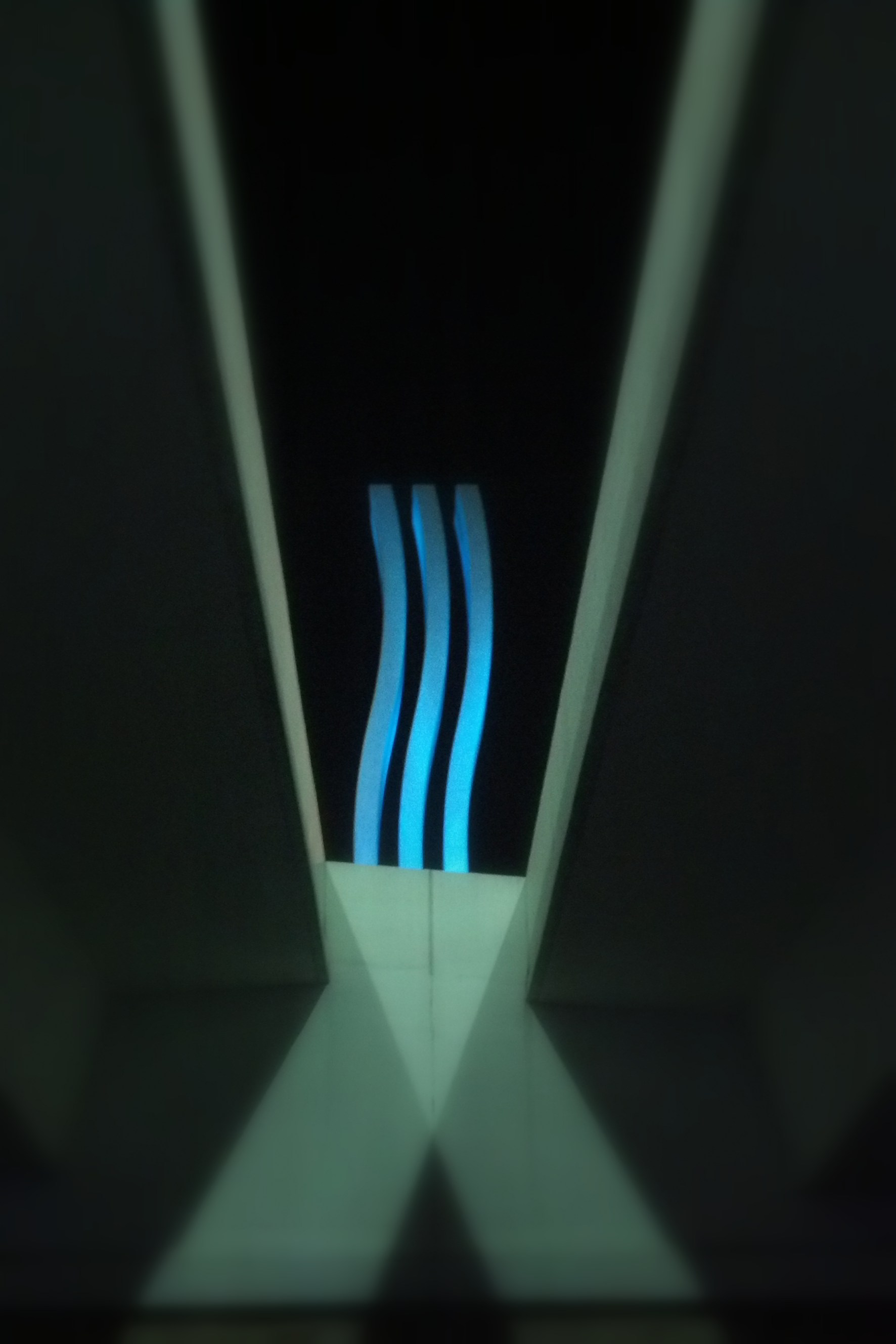
Pretty impressive right?
I think so.
If you have ever driven across the 35W bridge, you might have noticed the two thirty-foot sculptures in the median. These sculptures are interesting (to me at least) for a variety of reasons:
Reason One – They are made out of something called Photocatalytic Concrete, which removes pollutants such as carbon monoxide, nitrous oxides and sulfur dioxide from the air.
Reason Two – In their project description, Oslund and Associates describes the sculptures as:
“The symbol for water, inverted on its side, simply defines the transitions of the road on land to a bridge over water”
Reason Three - This one is of my own creation, but the three waves remind me of the Three Mississippi Rivers that exist inside the 72-Mile stretch that makes up the Mississippi National River and Recreation Area (a National Park btw). It fits so well that I find it hard to believe it is pure coincidence.
Anyways... here they are:
One Mississippi – The Prairie River
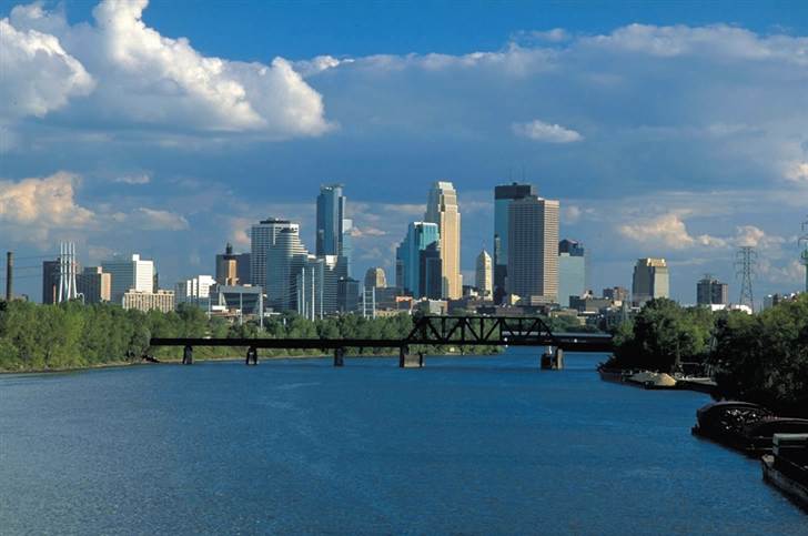
The Prairie River north of Minneapolis
At the northern-most tip of the Mississippi National River and Recreation Area, the confluence of the Mississippi and the Crow rivers mark the beginning of the Prairie River. This stretch of river extends 25.5 miles down to St. Anthony Falls in Minneapolis.
The characteristics of the Prairie River include:
- River banks that vary from a few to 30 feet in height.
- River valley ranges from less than two-tenths of a mile to about a mile wide
- Little floodplain, no backwater lakes, few braided channels and only small islands
Two Mississippi – The River Gorge
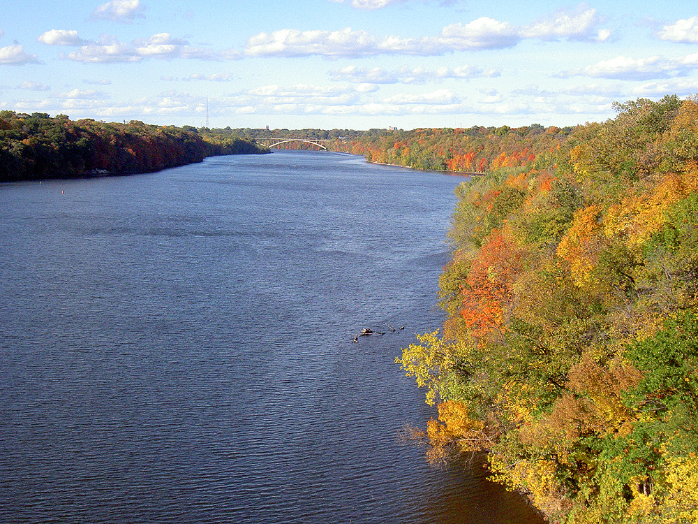
The River Gorge from the 46th Street/Ford Parkway bridge
The River Gorge runs 8.5 miles from St. Anthony Falls to the confluence of the Mississippi and the Minnesota Rivers and is the only true gorge along the river’s entire length (all 2,350 miles). The River Gorge features:
- 50 to 100+ foot bluffs (the tops being one to two-tenths of a mile apart)
- A 110-foot drop throughout the gorge (the steepest in the entire river)
Before the gorge was flooded by Locks and Dams 1 & 2, rapids raged through this area in high water, and in low water giant boulders emerged creating pathways to more than a dozen islands. Today only one remains.
Friends of the Mississippi River have some great in-depth info on the river gorge!
Three Mississippi – The Floodplain River

A barge on the Floodplain River
The Floodplain River runs from the confluence of the Minnesota and Mississippi Rivers, all the way to the Gulf of Mexico.
This river is characterized by:
- Broad valley and floodplains
- Many side channels, lakes, wetlands, and islands
- Bluffs up to 250-feet outlining the valley
“This is the river of Mark Twain and steamboats, the river of myth and metaphor” – Mississippi River Companion
So now you know what I think about every time I drive over the 35W bridge.
Boom knowledge. You’re welcome.
Check out the National Park Service’s Mississippi River Companion! (It’s where I obtained this knowledge).


